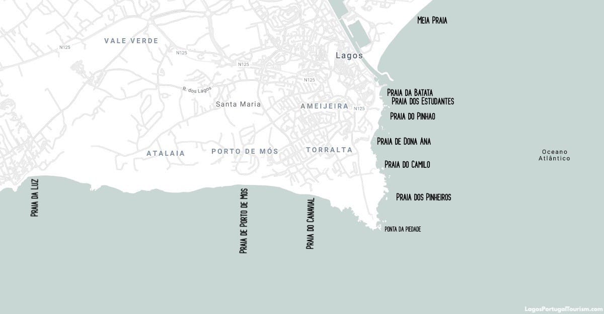
This map shows the beaches of Lagos. Praia da Batata, Praia dos Estudantes and Praia do Pinhão are small beaches in the center of town, separated from each other by cliffs (the first two are connected by a tunnel). Praia da Dona Ana and Praia do Camilo are the famous postcard beaches that bring everyone to town, and can be reached by walking or taking a bus or a tourist train from central Lagos.
A short walk over the cliffs from Praia do Camilo is the “secret” beach of Pinheiros, which is an unofficial nude beach. The lighthouse nearby stands above the stunning Ponta da Piedade promontory, and a 20-minute walk from there is another unofficial nude beach, Praia do Canavial, which also requires a short hike to reach.
To the west is Praia do Porto de Mós, which isn’t within reasonable walking distance from the center, but can be reached by bus. It’s mostly frequented by local families and those who enjoy surfing and other water sports.
Further west, just outside Lagos, is the village of Luz, which has another family-friendly beach, known to attract British and other European tourists. It’s a popular destination, but never as crowded as other favorite beaches in Algarve.
The northernmost beach in Lagos is Meia Praia, which is also the longest in town and one of the longest in the region. It’s best reached by bus.